Campbell’s Covered Bridge
A weekend drive, with no destination in particular, delivered me to an unexpected surprise. The sign on the side of a local road said “Campbell’s Covered Bridge”, and included an arrow to point me in the right direction.
With only a quarter of a tank of gasoline indicated on the dashboard, I hoped to combine tasks. The last quarter tank holds so much less than the first quarter tank, so fuel took priority. Luckily, the gas station was a few miles ahead, according to Garmin, and the bridge somewhere beyond that.
I was in Greenville County, South Carolina, exploring an area that was new to me. The weather consisted of a persistently pesky light drizzle, with temperatures in the 40’s. Wipers on, then off, then on… Not terribly unpleasant for a walk around a park, I thought, even with a camera hanging around my neck. Since there were, as yet, no highlights on this trip, I was hoping for a sign. And I got one.
There’s the sign!
Sharp right turn off the road! Blink, and you’ll miss it. I blinked…backed up, and pulled into the parking lot, next to 3 or 4 other cars. Apparently there’s a second entrance farther down the road with a tighter parking lot. A young man in formal ROTC dress told me so.
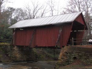
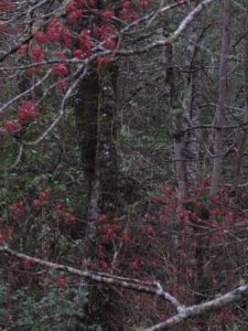
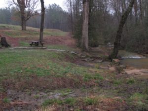
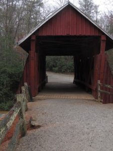
The red-sided bridge was down a gentle slope—very picturesque, I’m sure, when the maple trees are in full fall color, or as light green leaves unfurl in spring. The trees were a week or two away from new spring foliage. But the maples were in flower, which warmed up the grays and browns of bare forest twigs. And some yellow daffodils over by the picnic table brought cheer to what some would call a dreary day.
Jacket on, umbrella open, camera dangling. The slippery slope with all the water draining toward the stream from the field above limited access. Different shoes, different story.
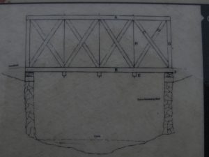
A diagram on the site.
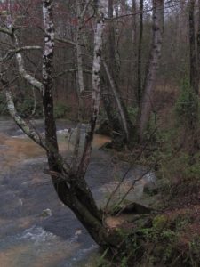
There’s something about the sound of a mountain stream…I just love it! Beaverdam Creek spills over smooth flat bedrock, and I imagine this would be a great place for the kids to splash around on a hot August afternoon. Bring a picnic lunch and art supplies for a quiet break.
Built and Rebuilt
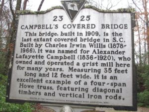
On August 24, 1908, 20″ of rain fell in one day, washing out the original bridge. Local residents used the rock shoal upstream to cross the water. A year later, Charles Irwin Willis (1878-1966) built the current 35′ x 12′ bridge on land belonging to Alexander Lafayette Campbell (1836-1920). The truss followed the contours of the land, so the bridge was not built square.
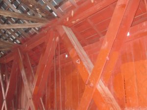 Campbell’s Covered Bridge has a four-span Howe truss on each side, with X-braces and vertical tie rods. William Howe, from Spencer, Massachusetts, patented this design in 1840, and it was often used for railroad bridges.
According to the Greenville County Recreation District, the Crescent Community Club restored the bridge in 1964, and Greenville County restored it again in 1980. The bridge was closed to vehicular traffic in 1984.
Campbell ran a corn grist mill downstream from the bridge. A dam built 75′ upstream created a mill pond, providing water to drive the mill. The Campbell grist mill closed in the 1950’s, but some of the stone foundations from the mill and the house can still be seen.
In 1979, E.O. Productions filmed a scene for the movie “The Day of Judgment”. Set in the 1920’s, an avenging angel rode a horse out of the bridge to see that justice was done!
The address is 171 Campbell’s Covered Bridge Rd., Landrum, SC. This is the last covered bridge in South Carolina—worth a visit.
This website has many seasonal photographs of the bridge that you may see but not copy without permission: https://www.scpictureproject.org/greenville-county/campbells-covered-bridge.html
